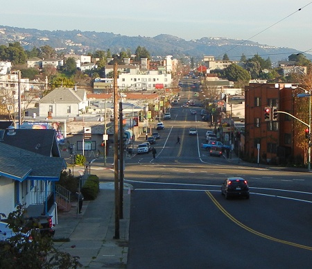
Sausal Creek is responsible for digging a floodplain that is rather wide just upstream from I-580. Here’s the view across it from Montana Street at MacArthur.
The squat tower just to the left of the speed limit sign is at the foot of Lincoln Avenue, and it’s at the same elevation as where I’m standing. That’s how wide the valley is. Here’s another view looking right down MacArthur.
The first cross street is Canon Avenue, the next one is Dimond Avenue leading up to the park, and beyond is the Fruitvale Avenue crossing. Here’s how the geology is mapped.
You can see that the stream valley is wide because three streams coalesce here at the edge of the Piedmont bedrock block. Restricted upstream, they enter the big alluvial fan (Qpaf) and have room to move and easy material to erode. It is curious that Sausal Creek hugs the west side of the valley; I suspect that tectonic movements may account for that, but only a decade or so of careful satellite altitude monitoring can answer my suspicion.


6 February 2013 at 5:16 pm
Dear Andrew,
These are great!! From an Oakland native. Maury Polse
7 February 2013 at 10:56 pm
I drive this area constantly – before it was just a hill – now I appreciate it much more.