This last week I decided to make new assault on a puzzle I featured here back in 2008: What was the gigantic rock that gave Rockridge its name? I’m here to declare the controversy over, no thanks to me.
A few things have changed since then. One is that I ponied up for a subscription to newspapers.com to get full access to this primary historical material, a resource not easily available to previous researchers (or me). Another is that I’ve acclimated to newspaper writing from the Yellow Journalism era and realized how much of it was blatant shilling for advertisers and not to be trusted.
People in early Oakland had no city parks, other than the handful of public squares in the downtown area (most of which are still there). But the compact young city was surrounded by farms and open fields. It was easy for those with time and cash to spare to pack a picnic basket, ride one of the horse-drawn trolley lines to the edge of town and find a lovely spot to lounge and pass the day away from the smoke, dirt, fumes and horse manure that accompanied nineteenth-century civilization. In Oakland proper, one such place was the upper valley of Temescal Creek out by the Livermore estate, north of Mountain View Cemetery. (East Oaklanders favored the valley of Laundry Farm, now known as Leona Heights.)
The Livermores relocated to San Francisco and sold their estate, which was devoured by various developers over the years as the city below expanded. The Claremont Country Club and golf course got a big part, but the higher hills stayed idle longer. Then the Laymance Real Estate Company got hold of the high ground in the late 1900s decade and laid out the lots and streets of an exclusive suburb for wealthy white men, today’s Upper Rockridge.
Laymance had to muster up as much pompous puffery as possible, and its totem was an outcropping it named Cactus Rock. Here’s its icon in the first “Rock Ridge Gazette” weekly advertising feature, printed on the back page of the Oakland Tribune in March 1910.
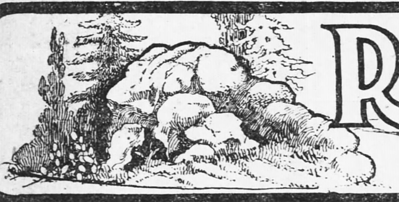
Read that for a taste of what I mean by “puffery.” The Gazette went through at least twenty-one numbers in this vein.
Laymance brought parties of fashionably dressed people to the site and touted “the famous old Rock Ridge picnic grounds” to suggest memories of the good old 1870s. The promotional photo of one such party, draping themselves all over Cactus Rock, became the cover image of “Rockridge,” the Arcadia Press book by Robin and Tom Wolf. It looks huge on page 46. The rock’s image also appeared on Laymance’s lavish marketing pamphlet.
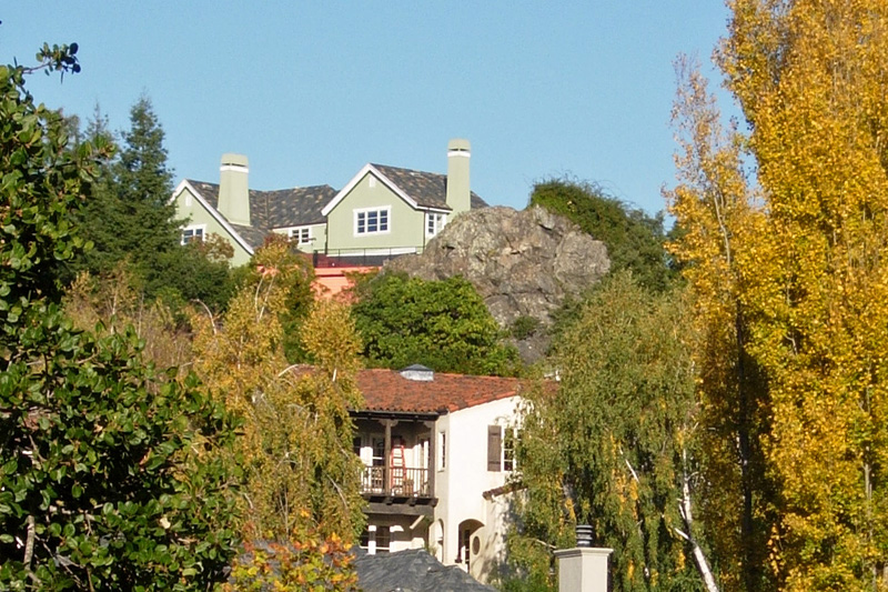
Today Cactus Rock is well hidden in a back yard overlooking Acacia Drive. Without a drone or access to the property, this is the best I can do to show it. It doesn’t look huge any more, but it still is, although maybe part of its base was removed.
After years of combing the area on foot, discounting imperfectly informed sources and tempting myself with the alternative of “Mount Ararat,” it’s finally clear to me that Cactus Rock was the subject of the old photo and the inspiration for the developers. “Rockridge Rock” is probably a legend in my own mind, suggested by taking the newspapers too seriously. I think the oldtime picnickers had lots of pleasant rocks to choose from.
Note that the drawing of Cactus Rock shows a clump of what looks like prickly pear at its base. Somewhere I have read that the first Spanish residents planted cactus near landmark boulders, in the early 1800s, and that a few ancient specimens are still around. That is to say, many rocks were “cactus rocks.” I hope a reader can retrieve that factoid for us.

31 January 2022 at 9:40 am
I don’t know about “back then”, but today some immigrant Mexicans plant cactus for making nopales. It makes sense that Californeos also planted cactus as a food source.
31 January 2022 at 3:47 pm
Have you read these articles? The Vespers were members of the Symphony Board when I worked there. I wish I went to one of their parties. Take care Dorothy – https://www.newspapers.com/clip/81415293/visit-the-country-in-an-oakland-garden/ -https://www.newspapers.com/clip/81414789/location-of-cactus-rock/ https://www.newspapers.com/clip/81415025/location-of-cactus-rock/
31 January 2022 at 4:49 pm
this must be the house on alpine terrace that went on sale some years ago – i think i tipped you off to it but it may have come too late for you to make it to a showing.
8 February 2022 at 2:42 pm
Prickly pear cactus was a staple food for both Indigenous people and Californios – groups who were intermarried, of course. There is a humongous cactus patch in Sunol High Valley that is well known in the family stories of the Muwekma Ohlone Tribe.
Also, cactus was handy as a boundary marker for rancheros. Cactus fencing sometimes would be used to confine cattle. Isn’t upper Rockridge/Temescal Creek the boundary between the lands of Domingo Peralta and his brother Antonio?
[The line between Antonio’s and Vicente (not Domingo)’s ranches ran up Indian Gulch. — Andrew]
As with Indian Rocks in Berkeley, many boulders were traditionally regarded as power places, used for spiritual contemplation or ritual.
But I was under the impression that the Bilger Quarry was the heart of the eponymous “Rock Ridge”…? Inquiring rockheads want to know.
Great article, Andrew!
9 February 2022 at 7:58 am
Here’s a Google Maps link to 3D view of Cactus Rock.
https://www.google.com/maps/place/6160+Acacia+Ave,+Oakland,+CA+94618/@37.843691,-122.239009,27a,35y,71.01h,79.12t/data=!3m1!1e3!4m5!3m4!1s0x80857d9437538321:0x510d68360906e439!8m2!3d37.8437888!4d-122.2381351
13 February 2022 at 1:51 pm
Phew.
11 November 2023 at 9:36 am
I know the people who own the property on which Cactus Rock sits, if you want a personal viewing/visit then please get in touch with me.