Temescal Creek, North Oakland’s largest stream, looms large in local history going back to Ohlone times. The Ohlones had a permanent camp a short distance east of Telegraph Avenue, where the creek’s perennial flow supported a health center. The people would gather in their sweat lodge for lengthy steam baths, then cool off in the stream. Early visitors described the place with the word temescal, a native name for similar facilities in Mexico, and the name stuck to the neighborhood as well as the creek.
Temescal Creek drains a hefty share of the Oakland Hills, including Claremont Canyon, Vicente Canyon, Temescal Canyon and Thornhill Canyon. The county flood control district has this handy map outlining Temescal Creek’s watershed, the land whose runoff provides its water.

In this post I’ll focus on the Bay end of the creek, where the stream is covered up and honored mainly as an idea. I define this stretch as starting just west of the Rockridge BART plaza at Forest Street, the point where it’s joined by its last tributary, Claremont Creek. This part.

Original stream course superimposed on the modern map. Numbers mark features in this post.
In the old days, this part of Temescal Creek flowed down a gentle slope across a wide, grassy alluvial plain―the East Bay flats―between low natural levees. Parts of the creek bed were willow thickets where the Ohlones’ agricultural fires did not penetrate. A large shellmound marked its mouth along the Bay. It’s thought that during Ohlone times, the streams in the East Bay coastal plain didn’t cut into the ground as deeply as today. The changes in land use set in motion by the Spanish and their successors led to fluvial incision and the formation of arroyos. Today the creek runs a good 20 feet below the surroundings.
When the Americans first took over this territory, they used the stream to establish property lines but otherwise left it alone, except to build bridges over it on the main roads. Then in 1871 “Captain” Edward Wiard opened the Oakland Trotting Park on his land near Shellmound Park, as seen in this 1876 map, and chose to cover the creek. That was the first culverting of the stream. By that time, its headwaters had been harnessed by Anthony Chabot’s dam for the Contra Costa Water Company, Oakland’s first municipal water provider. Farms, factories, canneries and other industries located near the creek in the next decades. They found its natural floods inconvenient.

Detail of the King map, from the Rumsey collection
Today the entire lower segment of Temescal Creek is encased in a concrete channel, bound by human needs. Most of it is covered up entirely. This part of the creek has some major constructions: freeways, the eight-track-wide railyard of Emeryville, Emery High School, the Children’s Hospital complex at MLK Boulevard, the Logan development at Temescal, the Rockridge BART station. These projects had the money to underground the creek and can’t be undone. The county flood control district entombed the rest for completeness’ sake, and between that agency and the home owners, the creek in their back yards will never be exhumed.
That leaves the creek to be memorialized by symbolic acknowledgments. I’ve visited them all to write this post. I’ll start in Rockridge and end at the Bay.
1. The Rockridge-Temescal Greenbelt, also known as Frog Park, has turned a 2000-foot stretch of culverted creekbed between Hardy Park and Redondo Playground into a rich neighborhood asset. In Hardy Park, at the upstream end, is a large grate over the culvert where you can stand and listen to the water.

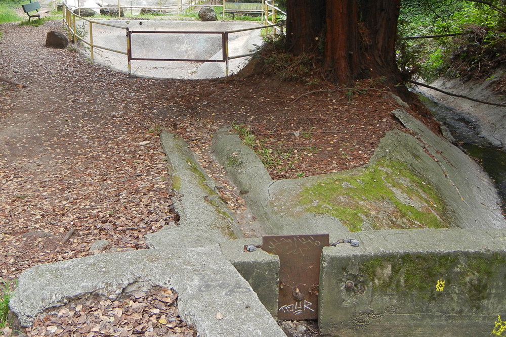
The rest of the greenbelt consists of a secluded path with understated exhibits and a faux streambed that can be filled with running water when the pumps are activated. This is the part behind the DMV building, site of the Lusk Cannery in the 1880s.

2. On Telegraph Avenue at 51st Street is this utility box with a stream-centered mural.

3. Just the other side of the PG&E substation, on Shattuck Avenue is this installation that deserves more visitors than it gets. The site was once a trolley yard.

The Children’s Hospital complex, a little farther west across the freeway, originated in a grant of land from the heirs of Solomon Alden, whose lavish farm estate straddled the creek and supplied Lusk’s cannery.
All of these places were part of the village of Temescal around the turn of the last century. Oakland annexed it in 1897, and you could say the town has been hidden as well as the stream. A 2012 Oakland North article has more detail on the Temescal segment of the creek.
From the hospital the stream culvert runs between the back yards of homes. The butt end of Genoa Street offers a glimpse. Large trees also mark the stream’s course, as they do elsewhere in Oakland. From here west, the stream flows across nearly level ground.
4. Adeline Street is in Emeryville here, barely west of the city line. The creek is recalled at 5200 Adeline in the Bakery Lofts development, a former factory that once straddled the creek. The creek can be heard through the pipe, which opens into the culvert.

5. The Oakland-Emeryville border turns west here and wanders with the creek for a couple of blocks. This segment is occupied by attractive little Temescal Creek Park, a joint project of the two cities. Here too are steel grates, near the east and west ends, where you can hear the stream below rustling.

6. One of Emeryville’s community gardens occupies a parcel on top of the culvert at the east end of 48th Street.

7. A short distance west on San Pablo Boulevard, facing Emery High School, is this little treatment honoring the creek.

8. Beyond more culvert about a half-mile west, the stream emerges at Horton Street in Emeryville’s exciting new Horton Landing Park, a pedestrian landmark featuring a dramatic bridge over the railroad tracks and connections to the Emeryville Greenway. Though final landscaping is still in progress, I think it’s already worth a trip from anywhere in the Bay area.

Crossing the bridge over the wide railyard, between its walls of new buildings, feels a little like going through rocky hills over a river gorge. The footpath itself curves, a nod to the buried stream beneath.

The exposed creek bed in this stretch is naked now. There may be plans to revegetate it, perhaps with native willows again.

The educational memorialization park west of the bridge is a meandering avenue of chiseled granite and etched glass exhibits about the Ohlone people: how they used to live and what they’ve gone through. It’s a starting point; the tribes are still here and need from the rest of us more than these exhibits.
The city’s park ends at Shellmound Street, at the old shoreline. The Emeryville Shellmound was the greatest topographic feature in the area, and the site is central in the little city’s history. As with the creek, the shellmound is honored more in its absence than it was during its presence.

9. The stream continues under the freeway to its current mouth on the Bay, free at last.

The coast here is part of the Emeryville Crescent State Marine Reserve, now just a park in embryo form. The mouth of the creek is not easily accessible yet; the birds and advancing pickleweed seem to like it that way despite the trash and traffic.
This is not exactly where the historical stream ran, but it will have to do for the next few centuries. Perhaps later generations will find opportunities to spring Temescal Creek from its prison. On the geological time scale, creeks like this roam about the landscape as they slowly build up the coastal alluvial plain.