Remillard Park is one of Berkeley’s “rock parks,” but it’s very different from its fellow rock parks, some of which I’ve written about (like here and here). People have urged me to check it out — not that I need urging — and last week I found the time to give it a close look.
The park preserves an old landmark of the Berkeley hills called Pinnacle Rock. It sits uphill from Cragmont Rock, which is typical Northbrae Rhyolite like the stuff in the other rock parks.

We’re lucky that in 1861, the eminent photographer Carleton Watkins was hired to record landmarks in what remained of the San Antonio Rancho under the ownership of Vicente and Domingo Peralta. He printed two photos of Pinnacle Rock, one that’s been featured in books and newspaper articles and a second one I’m identifying here for the first time.
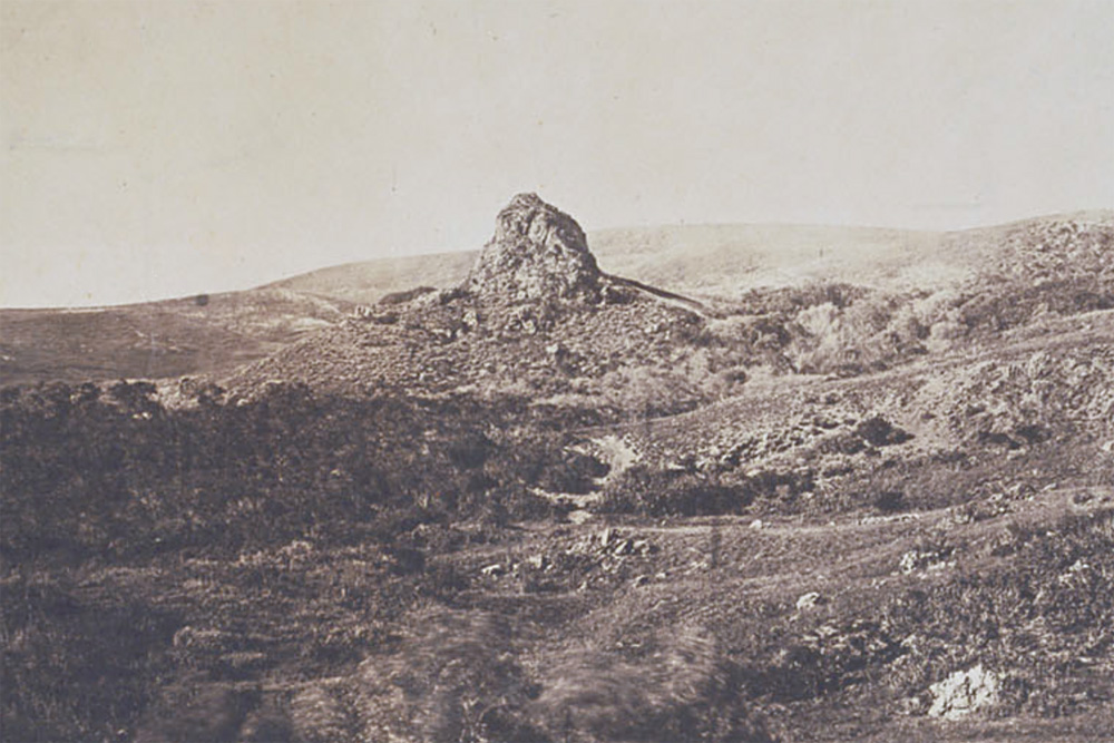
Pinnacle Rock from the south, not, as some assert, from Cragmont Rock.
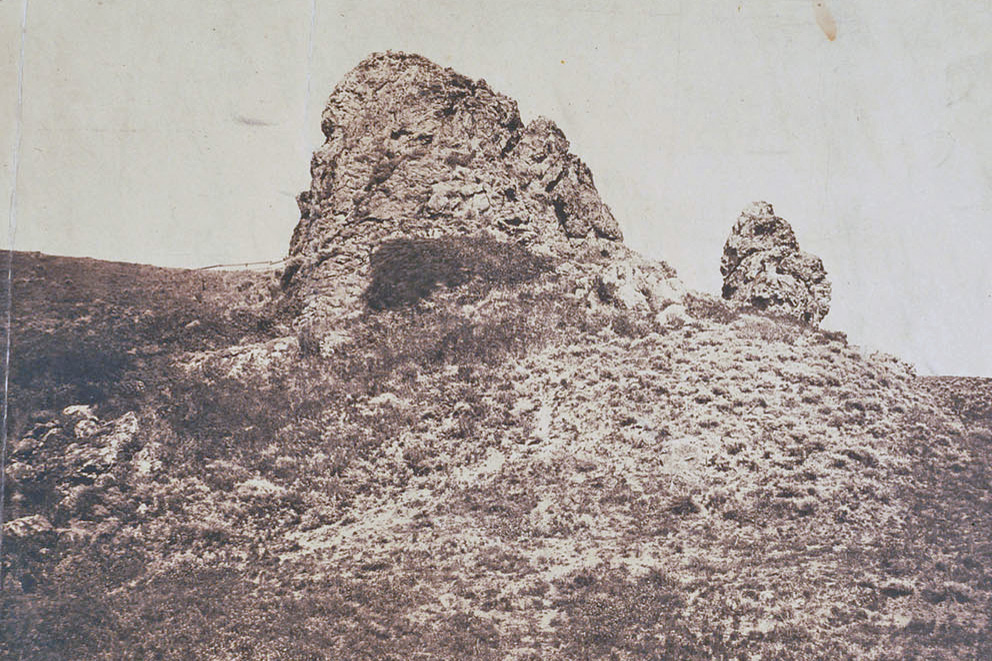
Pinnacle Rock from the west. Images courtesy Bancroft Library, cleaned up a bit by me.
Around the turn of the century, the land in the Berkeley hills was purchased, subdivided and developed as particularly elegant streetcar suburbs: Cragmont, Northbrae, Thousand Oaks and so on. Peter Remillard, the wealthy brickmaker and prodigious landowner who got his start in Oakland, acquired the Pinnacle Rock property, but any plans he had for an estate there died with him in 1904. The land stayed in the family, and in 1963 his daughter Lillian, better known as the fabulous socialite Countess Dandini, gave it to the city of Berkeley for a park on the condition it bear the family’s name.
More about the rock later; that’s the top part of the park. The bottom part of the park is interesting too.
The south and southeast side of Remillard Park is an undeveloped stretch where Keeler Avenue abruptly gives way to Keeler Path, which crosses a scooped-out slope to intersect Sterling Avenue, where Keeler Avenue resumes. But the land is subdivided into housing lots and a standard right-of-way.

This is a big, persistent landslide scar, the uppermost part of the notorious Keith Slide, Berkeley’s largest active landslide. The vacant plots are telltale evidence as well as the land itself. The newspapers have reported houses around here that were damaged and destroyed by mudslides, from the 1940s to the 1990s, but none at this exact location. Keeler Avenue was platted in the 1900s decade and is shown as continuous in street maps dated through 1949, but the gap appears in the 1973 map. My guess is that houses were never built here, because the papers would otherwise have reported their destruction.
Keeler Avenue’s name honors the remarkable Charles Keeler, whose book The Simple Home was the guidestar for the local Arts & Crafts movement. Among his other precepts based on “conjuring the beauties of nature into being at [one’s] very doorstep,” Keeler praised the narrow, winding lanes that make the hill neighborhoods both so charming and so dangerous during fires or earthquakes. I think it’s fitting that nature, in the form of a creeping landslide, imposed itself in turn on a neighborhood he conjured into being.
In Remillard Park, the land has the classic scooped-out shape, steep headscarps and groundwater leakage of a slump. This photo shows the biggest scoop behind a drainage feature, one of at least two built to control the slump.
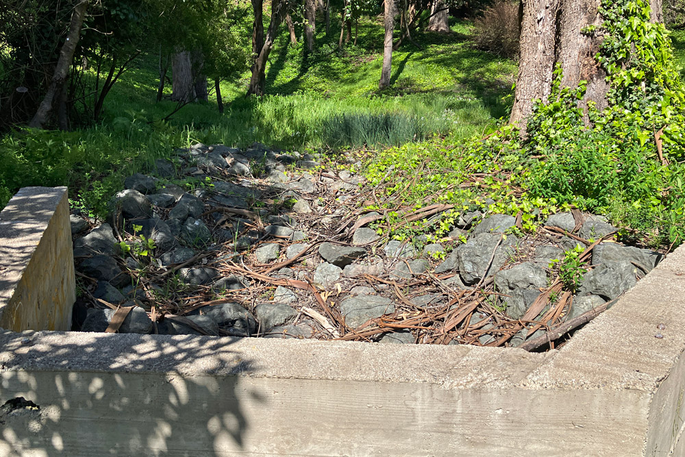
The flat floor is soaked right now and nurturing wetland vegetation. Little streams are trickling into it. Check it out, but careful where you step.
Pinnacle Rock is still imposing, mostly untouched except by vegetation that has crept in since the Ohlones were prevented from their practice of regular burning.
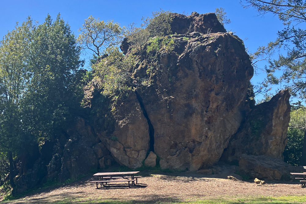
Even in the old photos, the rock appears quite different from those lower on the slopes. Unlike the smooth faces and rounded surfaces of the Leona Rhyolite outcrops, Pinnacle Rock is rugged and rough at all scales from eyeball to fingertip.

I climbed the rock, which is feasible, with care, even for a guy in his seventies, and the view from the top rewarded the effort.

Cragmont Rock in the middle distance.
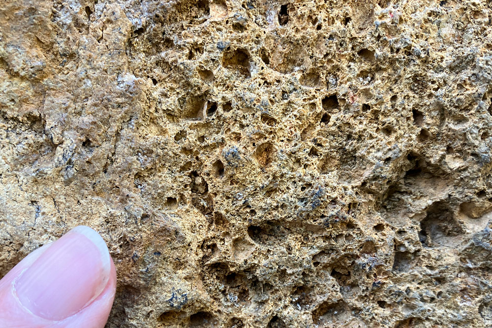
Some people say this rock consists of the Leona volcanics, which has a similar reddish color and crops out nearby, but up close it’s quite different. The color, when it can be discerned under a carpet of lichens, is not a surface stain but integral, and the rock is shot with disorganized veins of hydrothermal quartz.

Moreover, the rock responds to hydrochloric acid on every surface, a sign that it’s impregnated with calcite and probably other carbonates. Its ragged, almost fractal surface indicates that rain and weather are successfully attacking it. Pockmarks all over its upper surface contain loose particles of the red-brown matrix set free by dissolution, and small annual plants seem to like them.

To end the suspense, I’ll say that this is considered to be the elusive “silica-carbonate rock” I’ve been seeking for a few years now. This material, also known as listwanite, results when hot carbonate-rich fluids invade serpentine rock and transform its minerals. It’s associated with mercury and gold mineralization, although not consistently.
At this point I would usually insert part of the geologic map of this area, but I don’t fully trust it. Suffice it to say that Pinnacle Rock is mapped within a belt of serpentinite, which I can’t yet confirm but would make sense. Most of the great landslides of the Berkeley and El Cerrito hills originate in serpentinite. I did find one boulder that might preserve a thin remnant of the original serpentine.

In addition to these observations, I noted two different sets of faults. The more prominent set is oriented due north-south and displays nice slickensides.
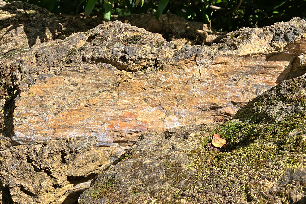
They’re especially plain along the base of the west side, facing the picnic tables. These appear to be “dry” without associated mineral veins. The lesser set is orthogonal to them and associated with calcite veins, the whitish crusts in this photo.

I can’t yet speculate which set is older. But the first set is roughly parallel to the nearby Hayward fault, and they probably were active when this chunk of the Earth’s crust was being hauled north during the past few million years.
It’s easy to picture that when volcanism was emplacing the Northbrae Rhyolite, farther downhill, it also punched a pulse of chemically active fluid up through the serpentine that created a chimney of listwanite, which has been gradually emerging via erosion ever since.
The pinnacle is fragile, penetrated by cracks at all scales. Its tumbledown structure lends itself to rock climbers, and Berkeley’s climbing pioneers practiced their rope-based techniques on Pinnacle Rock starting a century ago, leaving many bolts and pitons that still see use. Bouldering routes on the rock are marked with climbers’ chalk.
On the downhill side of Pinnacle Rock, the small pinnacle shown in the 1860s photo is still there.

Many chunks seem to have fallen off the main rock since then, most likely in the 1868 earthquake and possibly in 1906 too. If an earthquake strikes while you’re standing here, look sharp and step away!


